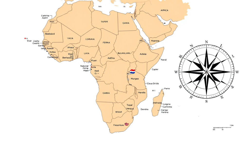
Map of African Countries: List, Capitals & Regions
Few things put the sheer scale of Africa into perspective like a good map. You see 54 countries spanning from the Mediterranean to the Cape of Good Hope, each with its own capital, borders, and story. This guide walks you through that map, from the largest country by area (Algeria at over 2.3 million km²) to printable resources and regional breakdowns you can use right now.
Countries in Africa: 54 recognized sovereign states ·
Largest country by area: Algeria (2,381,741 km²) ·
Smallest country by area: Seychelles (452 km²) ·
Most populous country: Nigeria (over 223 million)
Quick snapshot
- 54 sovereign states (GIS Geography, a geography education publisher)
- Algeria is largest by area (GIS Geography, a geography education publisher)
- Seychelles is smallest (GIS Geography, a geography education publisher)
- 54 capitals, one per country
- Most populous capital: Cairo, Egypt
- Free labeled maps available from GIS Geography
- Five major regions: North, East, West, Central, Southern
- Each region has distinct geography and culture
- UN classification used
- Free PDF downloads from FreeWorldMaps.net (independent map provider)
- Versions with and without capitals (FreeWorldMaps.net (independent map provider))
- Also available as labeled political maps (FreeWorldMaps.net (independent map provider))
Africa’s map is not just a static image — it’s a tool for understanding the continent’s political evolution, from colonial boundaries to modern statehood. Anyone looking at a labeled map from any reputable source gets a snapshot of 54 distinct political entities.
54 countries, 54 capitals, and one pattern: the political map of Africa is a patchwork of lines drawn by colonial powers and later renegotiated by independent states. The table below captures the key numbers that define the continent.
| Attribute | Value | Source |
|---|---|---|
| Total countries | 54 | GIS Geography |
| Total area | 30,370,000 km² | Britannica (reference publisher) |
| Population (2025 est.) | 1.5 billion | United Nations |
| Highest point | Mount Kilimanjaro (5,895 m) | Britannica |
| Longest river | Nile River (6,650 km) | Britannica |
| Largest country | Algeria (2,381,741 km²) | CIA World Factbook (U.S. government) |
| Smallest country | Seychelles (452 km²) | Britannica |
| Most populous country | Nigeria (>223 million) | CIA World Factbook |
| Number of capitals | 54 | Alabama Maps (university geography resource) |
| Landlocked countries | 16 | World Population Review (demographic data site) |
What countries are on the map of Africa?
List of all 54 African countries
- Algeria, Angola, Benin, Botswana, Burkina Faso, Burundi, Cabo Verde, Cameroon, Central African Republic, Chad, Comoros, Congo (Republic), Congo (Democratic Republic), Côte d’Ivoire, Djibouti, Egypt, Equatorial Guinea, Eritrea, Eswatini, Ethiopia, Gabon, Gambia, Ghana, Guinea, Guinea-Bissau, Kenya, Lesotho, Liberia, Libya, Madagascar, Malawi, Mali, Mauritania, Mauritius, Morocco, Mozambique, Namibia, Niger, Nigeria, Rwanda, São Tomé and Príncipe, Senegal, Seychelles, Sierra Leone, Somalia, South Africa, South Sudan, Sudan, Tanzania, Togo, Tunisia, Uganda, Zambia, Zimbabwe (GIS Geography).
Map highlights by region
- North Africa: Morocco, Algeria, Tunisia, Libya, Egypt, Sudan (sometimes considered part of Northeast Africa).
- East Africa: Kenya, Tanzania, Uganda, Ethiopia, Somalia, Rwanda, Burundi, South Sudan, Djibouti, Eritrea.
- West Africa: Nigeria, Ghana, Côte d’Ivoire, Senegal, Mali, Niger, Burkina Faso, Benin, Togo, Guinea, etc.
- Central Africa: Cameroon, Central African Republic, Chad, Congo, Democratic Republic of Congo, Gabon, Equatorial Guinea, São Tomé and Príncipe.
- Southern Africa: South Africa, Botswana, Namibia, Zimbabwe, Mozambique, Zambia, Angola, Lesotho, Eswatini, Madagascar.
The pattern: This is the standard list used in most educational materials and United Nations groupings. When you look at a political map of Africa, every one of these countries appears as a colored polygon.
For students, teachers, and travelers, having a complete country list is the foundation of any Africa map quiz or learning exercise. The U.S. government’s White House archive (historical educational worksheet) even used a numbered format for African country identification.
How many countries are in Africa?
Total count and international recognition
The widely accepted number is 54 — the count used by the African Union and the United Nations. That figure is consistent across major atlases and data sources (GIS Geography). However, some resources list 56 or 55 when they include territories like Western Sahara or count disputed regions.
Disputed territories (e.g., Western Sahara)
- Western Sahara is claimed by Morocco and the Sahrawi Arab Democratic Republic; it is not universally recognized as a sovereign state (United Nations).
- Other border disputes exist in the Horn of Africa (e.g., Somalia-Ethiopia border).
The trade-off: If you need a map for official or classroom use, stick with the 54-country model. The disputed areas are typically marked with dashed borders or special labels on political maps.
Where can I find a printable map of Africa with capitals?
Free PDF downloads
Several websites offer free, high-quality printable maps of Africa that include both country outlines and capital cities. FreeWorldMaps.net provides a free printable Africa map in PDF vector format suitable for A4 printing, with country borders and a political color scheme. GIS Geography also offers two versions: one with only countries and one with capital cities — both free to download (GIS Geography).
Recommended sources for high-quality maps
- Alabama Maps (University of Alabama) — hosts a PDF titled “Capitals of Africa” that includes capitals and major cities (Alabama Maps).
- World Map Blank — offers a labeled political map of Africa as a free JPG and PDF (WMB Maps (map resource site)).
- Scribd — hosts a document “African Countries and Their Capitals” with 56 entries (though the official count is 54) (Scribd (document sharing platform)).
What this means: You can get a printable Africa map with capitals for free from at least three solid sources. The versions with capitals are especially useful for geography quizzes or classroom wall displays.
The implication: For educators and learners, these free resources remove the barrier to high-quality classroom materials.
What are the major regions of Africa?
North Africa
- Countries: Morocco, Algeria, Tunisia, Libya, Egypt, Sudan (sometimes included).
- Geography: Sahara Desert, Atlas Mountains, Mediterranean coastline.
- Cultural ties: Arab and Berber influences, Arabic as dominant language.
East Africa
- Countries: Kenya, Tanzania, Uganda, Rwanda, Burundi, South Sudan, Ethiopia, Eritrea, Djibouti, Somalia.
- Geography: Great Rift Valley, savannas, Mount Kilimanjaro, Lake Victoria.
- Notable: Cradle of humankind, Swahili language and culture.
West Africa
- Countries: Nigeria, Ghana, Côte d’Ivoire, Senegal, Mali, Burkina Faso, Niger, Benin, Togo, Guinea, Sierra Leone, Liberia, Gambia, Guinea-Bissau.
- Geography: Coastal plains, Sahel region, Niger River.
- Economic hub: Nigeria has the continent’s largest economy.
Central Africa
- Countries: Cameroon, Central African Republic, Chad, Democratic Republic of Congo, Republic of Congo, Gabon, Equatorial Guinea, São Tomé and Príncipe.
- Geography: Congo Basin rainforest, active volcanoes.
- Key fact: DRC is the second-largest country by area in Africa.
Southern Africa
- Countries: South Africa, Botswana, Namibia, Zimbabwe, Mozambique, Zambia, Angola, Lesotho, Eswatini, Malawi, Madagascar.
- Geography: Kalahari Desert, Okavango Delta, Cape of Good Hope.
- Economic diversity: South Africa is the most industrialized.
The catch: Regional groupings can vary — some sources put Sudan in North Africa, others in East Africa. When you download a map from FreeWorldMaps.net, the regions are often color-coded, making it easy to see the five-zone structure at a glance.
How can I create my own custom map of Africa?
Using MapChart.net
MapChart.net (free online map tool) lets you create a fully customizable political map of Africa. You can color each country individually, add a legend, and download as PNG or SVG. The tool is popular among educators and students for making study aids or quiz maps.
Editable SVG and color-coding
- Select individual countries and assign colors.
- Add labels or leave blank for testing.
- Export as high-resolution image without watermarks (MapChart.net).
For users who prefer offline editing, you can download a blank SVG or PDF of Africa from sources like Vecteezy (vector graphics marketplace) and edit in Adobe Illustrator or Inkscape.
MapChart.net is free and browser-based, but it doesn’t include a built-in capital cities layer. You’ll need to add capitals manually or overlay a separate capital map from GIS Geography. For a quick color-coded reference, it’s unbeatable.
The pattern: Custom map tools empower users to tailor the geography to their specific teaching or study needs.
Clarity: What’s known and what’s uncertain
Confirmed facts
- 54 countries are members of the African Union (United Nations).
- Algeria is the largest country by area (2,381,741 km²) (CIA World Factbook).
- Nigeria is the most populous country in Africa (over 223 million) (CIA World Factbook).
- Africa spans approximately 30.37 million km² (Britannica).
What’s unclear
- Western Sahara’s status remains disputed — not universally recognized as a sovereign state (United Nations).
- Some borders in the Horn of Africa (e.g., Somalia-Ethiopia) are contested, and map conventions vary.
- Country-count references can vary between 54 and 56 depending on inclusion of non-sovereign territories or counting errors (GIS Geography).
- The regional classification of Sudan (North vs East Africa) varies by source.
Perspectives from experts
“Africa, the second largest continent, is bounded by the Mediterranean Sea, the Red Sea, the Indian Ocean, and the Atlantic Ocean.”
Britannica (reference publisher)
“The African continent comprises 54 recognized states with a combined population of over 1.4 billion.”
United Nations
These two authoritative voices frame the map of Africa as both a geographic fact and a political reality. The continent’s boundaries are settled in official UN usage, even if local disputes persist.
Related reading: Goodwill Bins Near Me: How to Find & Shop Outlets · CVS Near Me: Find Stores, Hours & Directions Fast
Related coverage: political map of African capitals fördjupar bilden av Map of African Countries: Political Map with Capitals.
Frequently asked questions
What is the smallest country in Africa?
Seychelles, with an area of just 452 km², is the smallest country on the continent.
Which African country has the most population?
Nigeria, with an estimated population of over 223 million as of 2025.
What is the capital of Egypt?
Cairo is the capital of Egypt and also the most populous city in Africa.
What is the main language spoken in South Africa?
South Africa has 11 official languages, with the most widely spoken home languages being isiZulu and isiXhosa (South African Government).
Is Madagascar part of Africa?
Yes, Madagascar is geographically an African island country in the Indian Ocean, and it is a member of the African Union.
What is the orientation of the Africa map?
Most political maps of Africa are oriented with north at the top, with the Mediterranean forming the northern border and South Africa at the bottom.
How many landlocked countries are in Africa?
There are 16 landlocked countries in Africa, including Botswana, Burkina Faso, and Zimbabwe (World Population Review).
For anyone studying the map of African countries, the combination of a printable map, a region breakdown, and a country-capital table gives a complete foundation. Whether you’re a student prepping for a quiz, a teacher assembling classroom materials, or a traveler planning a route, the tools are free and widely available. For learners in the U.S. looking at classroom-ready resources, the choice is clear: download a political map from GIS Geography or FreeWorldMaps.net and start labeling — that’s the fastest path to mastering the African continent.
More related posts
 Best Auto Insurance Companies in Ireland: Compare & Save 2025
 Jack in the Box: History, E. coli Outbreak, Menu & More
 Canker Sore on Lip: Causes, Treatment & Relief Tips
 Best Galaxy Z Fold5 to Buy in Ireland: Deals & Prices
 Shiba Inu Price Prediction 2026–2040: Will SHIB Reach $1?
 Salt Fat Acid Heat: The 4 Pillar of Cooking Explained
 Is SNL New Tonight? Check Schedule and Host
 Cast of Landman – Full Actors and Characters Guide